A table of all the different layers can be found at the right-hand side of the screen. To activate and deactivate layers on the live map, follow these instructions:
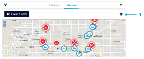
- Press on the layers icon on the right hand side of the live map screen.
- A sidebar appears with a list of all available layers.
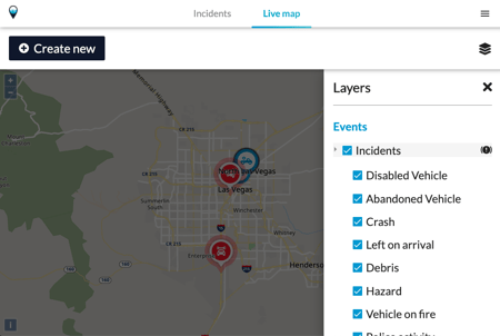
- To turn these layers on and off, either press the checkbox next to the label or on the label itself.
- A blue check mark means that the layer is turned on. You can view and interact with it on the map.